viDoc® light
Technical Data
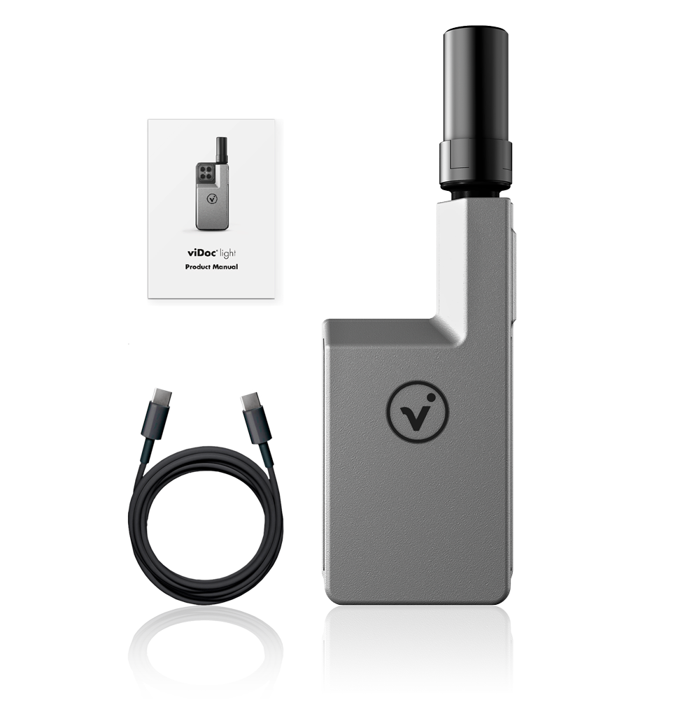
Included in delivery
> GNSS antenna (standard or performance)
> Charging cable
> User manual
The viDoc® is compatible with:
iPhone Pro or iPad Pro recommended.
iOS: Find out from your app provider which iPhones are supported and how, and whether compatibility with viDoc® is possible.
Android: Find out from your app provider which Android devices are supported and how, and whether compatibility with viDoc® is possible.
Unity: Find out from your app provider which Unity devices are supported and how, and whether compatibility with viDoc® is possible.
Note: Not every App (iOS / Android / Unity) is supported.
viDoc® light
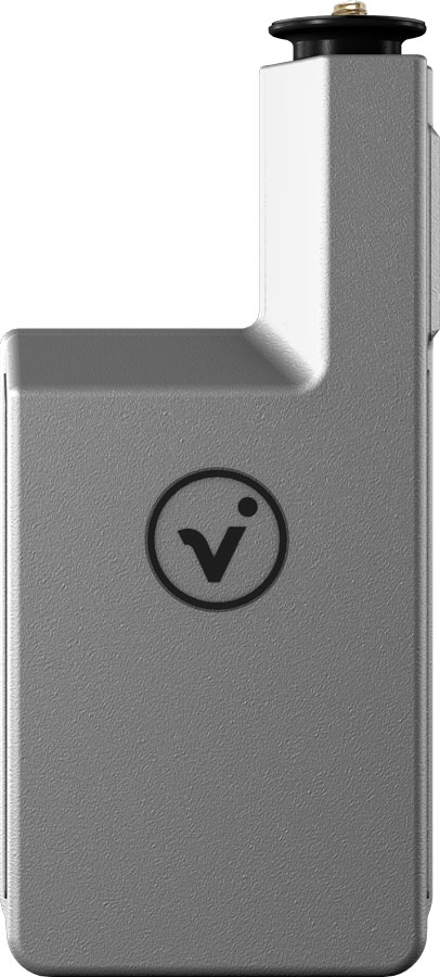
| Measurements | 161 x 75 x 23 mm |
| Weight | 285 g |
| Temperature range | –5 up to +35°C |
| Humidiy | 5 up to 95% (not condensing) |
GNSS antenna standard
| |
| Measurements | 55.6 mm x 27.5 mm |
| Weight | < 19g |
| Waterproof status | IP67 |
| Operating temperature | -40 up to +75 °C |
| Storage temperature | -50 up to +80 °C |
| Humidiy | Up to 95% |
| Polarization | RHCP |
| Satellite signals | GPS: L1/L2 BeiDou: B1/B2/B3 Galileo: El/E5b GLONASS: G1/G2 |
| Coverage | 360° |
| Supply voltage | 3 up to 16 VDC |
| Power consumption | < 35 mA |
| LNA gain | 36 ± 2 dB |
| Noise figure | < 2 dB |
| V.S.W.R. | < 2.0 |
| Measure angle1 | 0° = high precision 45° = low precision 90° = poor precision |
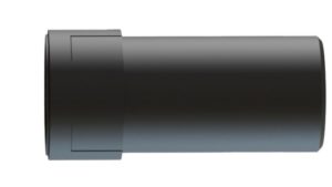
GNSS antenna performance
| |
| Measurements | 55.6 mm x 27.5 mm |
| Weight | < 19g |
| Waterproof status | IP67 |
| Operating temperature | -40 up to +75 °C |
| Storage temperature | -50 up to +80 °C |
| Humidiy | Up to 95% |
| Polarization | RHCP |
| Satellite signals | GPS: L1/L2 BeiDou: B1/B2/B3 Galileo: El/E5b GLONASS: G1/G2 |
| Coverage | 360° |
| Supply voltage | 3 up to 16 VDC |
| Power consumption | < 35 mA |
| LNA gain | 40 ± 2 dB |
| Noise figure | < 2 dB |
| V.S.W.R. | < 2.0 |
| Measure angle1 | 0° = high precision 45° = high precision 90° = high precision |
Performance specifications
Constellation-independent, flexible signal tracking, improved positioning under challenging environmental conditions2 with multi-satellite use. Reduced downtime in the event of loss of signal (up to 5 seconds).
The following satellite signals are used simultaneously:
GPS: L1C/A (1575.42 MHz); L2C (1227.60 MHz)
BeiDou: B1I (1561.098 MHz); B2I (1207.140 MHz)
Galileo: E1-B/C (1575.42 MHz); E5b (1207.140 MHz)
GLONASS:
L1OF (1602 MHz + k*562.5 kHz, k = –7,…, 5, 6)
L2OF (1246 MHz + k*437.5 kHz, k = –7,…, 5, 6)
QZSS
Positioning services3
| Device type | Multi-band GNSS high precision receiver |
| Accuracy of pulse signals | RMS 30 ns 99 % 60 ns |
| Frequencies of pulse signals | 0.25 Hz up to 10 MHz |
| Convergence time | RTK < 10 sec |
| Static survey RTK position accuracy | Horizontal acc.: 1 cm + 1 ppm Vertical acc.: 1 cm + 1 ppm |
| RTK run up/ramp up time4 | Cold start (sec) up to 90 sec At operating temperature up to 8 sec |
| RMS5,6 measurement accuracy (after system calibration, measured with performance antenna) | Horizontal acc.: 5 mm at 15 min Vertical acc.: 8 mm at 15 min Horizontal acc.: 10 mm at 30 min Vertical acc.: 15 mm at 30 min |
| Speed accuracy | 0.05 m/s |
| System limits | Height: 5.000 m Acceleration: < 4 g Speed: 500 m/s |
| IMU | 6-axis sensor 16-bit digital, triaxial accelerometer 16-bit digital, triaxial gyroscope and geomagnetic Angle accuracy: < 0.3° Scan rate: < 100 Hz Temperature measurement: permanent Acceleration rate: < 4 g Sensitivity temperature drift: ± 0.03 % / K Gyroscope operating rate: < 250°/s |
Power supply:
Operating times in continuous operation
| Receive and transmit | max. 6 hours |
| With active laser module | max. 5 hours |
| Under real conditions | max. 6 hours |
| Battery pack | LiPo, 2 x 1,200 mAh, 7.4 Wh, 3.7 V |
Model accuracy7
absolute position and height (relativ)
| with control points | < 1 cm |
| only via RTK positioning | < 5 cm |
| only with LIDAR (iOS) | < 10 cm |
1 High precision = technical accuracy up to 1 cm
Low precision = susceptible to fluctuations due to external influences, susceptible to shading >180°
Poor precision = very susceptible to fluctuations due to external and internal influences
2 Challenging GNSS environments are places where there is sufficient satellite availability for the receiver as a prerequisite for minimum accuracy, but where the signal can be partially shaded or reflected by trees, buildings and other objects. The actual results may vary due to the location and atmospheric activitiy, due to strong flickering, the condition and availability of the satellite system and the degree of multipath scattering and signal coverage.
3 Precision and reliability can be affected by certain factors such as multipath scattering, obstacles, satellite geometry and atmospheric conditions. The stated specifications require stable setups, a clear view of the sky, an environment free of electromagnetic interference and multipath scattering, optimal GNSS configurations and, in addition, surveying methods as they are usually used for surveys of the highest order with occupation times adapted to the base lengths. Baselines over 30 km in length require ephemeris accuracy and occupation times of up to 24 hours may be necessary to achieve high-precision static specification.
4 Accuracies may be affected by atmospheric conditions, multipath signals, shadowing and satellite geometry. The reliability of the initialisation is permanently transmitted to ensure the highest quality. Compensations are solved on the software side.
5 RMS efficiency is based on repeatable on-site measurements. The achievable accuracy and the initialization time can vary depending on the type and performance data of the receiver and antenna, the geographic location of the user, atmospheric conditions, scintillation intensity, the status and availability of the GNSS constellation, the degree of multipath scatteing and the proximity to shading (e.g. from large trees and buildings) vary. Validation in different situations on site.
6 Measurement iterations based on 1 minute. Better position accuracy through error rate filtering.
7 The models were mapped with a viDoc® Rover and an iPhone15 Pro Max. The model accuracy depends on the environmental conditions and the calculation settings. Results after Postprocessing with an photogrammetry software.